Project Background
A SaaS GPS fleet tracking platform built for New Zealand logistics and contracting companies. The system provides real-time vehicle tracking, route optimization, fuel cost monitoring, and geofencing through a web dashboard and mobile apps for fleet managers and drivers. Integration with the Iridium satellite network ensures 24/7 tracking coverage in remote areas where cellular connectivity fails.

The platform is actively used by NZ-based companies including Clarkson Electrical, Harrison Grierson, and Platform 4.
Client: New Zealand-based SaaS company serving the fleet management market
Industry: Fleet Management / GPS Telematics
The Initial Request
New Zealand logistics and contracting companies operate fleets across rural corridors, mountainous terrain, and remote job sites — environments where standard GPS tracking tools fail at the moments when visibility matters most.

The client needed a platform that solved four operational problems:
Coverage gaps outside the main centers. Large parts of the country are rural or mountainous, and cellular-based GPS trackers lose signal across much of it. For operators running civil, utility, and contracting work beyond urban corridors, that produces blind spots precisely where a vehicle is hardest to reach — and makes the tracking record unreliable for billing and dispatch decisions.
Fuel spend disconnected from vehicle movement. Fuel purchase records and location data lived in separate systems. There was no practical way to check a transaction against where the vehicle actually was at that moment, or to attribute consumption to specific routes and jobs. Spotting waste meant manual reconciliation after the money was already spent — and without cross-referencing, fuel card misuse went undetected.
Unmeasured time at sites. Locating the right access point, unloading, and getting away again absorbs a significant share of the working day, but without automatic site detection none of it is recorded. Arrival and departure were logged by hand or not at all — making billing approximate and dispatch blind to whether a driver is still on-site or has moved on.
No driver-facing operational tool. Operational data sat in back-office systems. Drivers had no access to route guidance, job details, or site information while on the road — relying on phone calls and paper instructions for everything.
The client hired Empeek to build the complete platform — web dashboard, mobile apps, satellite integration, and fuel supplier APIs — as a production SaaS.
Challenges
Dual-connectivity tracking without data gaps. Switching between cellular and Iridium satellite creates potential position gaps during handoff. The vehicle’s location is unknown during the transition — and in fleet tracking, a missing segment means the dispatcher cannot verify where a driver was or how long a job took.
Fuel card fraud detection across four suppliers. Mobil, BP, Caltex, and UBP each provide transaction data in different formats, with varying data fields and update frequencies. Detecting fuel card misuse required unifying four incompatible data streams into a single cross-referenceable dataset.
Geofencing accuracy in urban environments. Dense buildings degrade GPS accuracy by 10–30 meters, causing false geofence triggers. A vehicle on an adjacent street can appear to be inside a geofenced job site — generating false arrival events, incorrect billing time, and eroding trust in the system.
Process
Empeek designed and built the platform as a multi-tenant SaaS with five interconnected components.
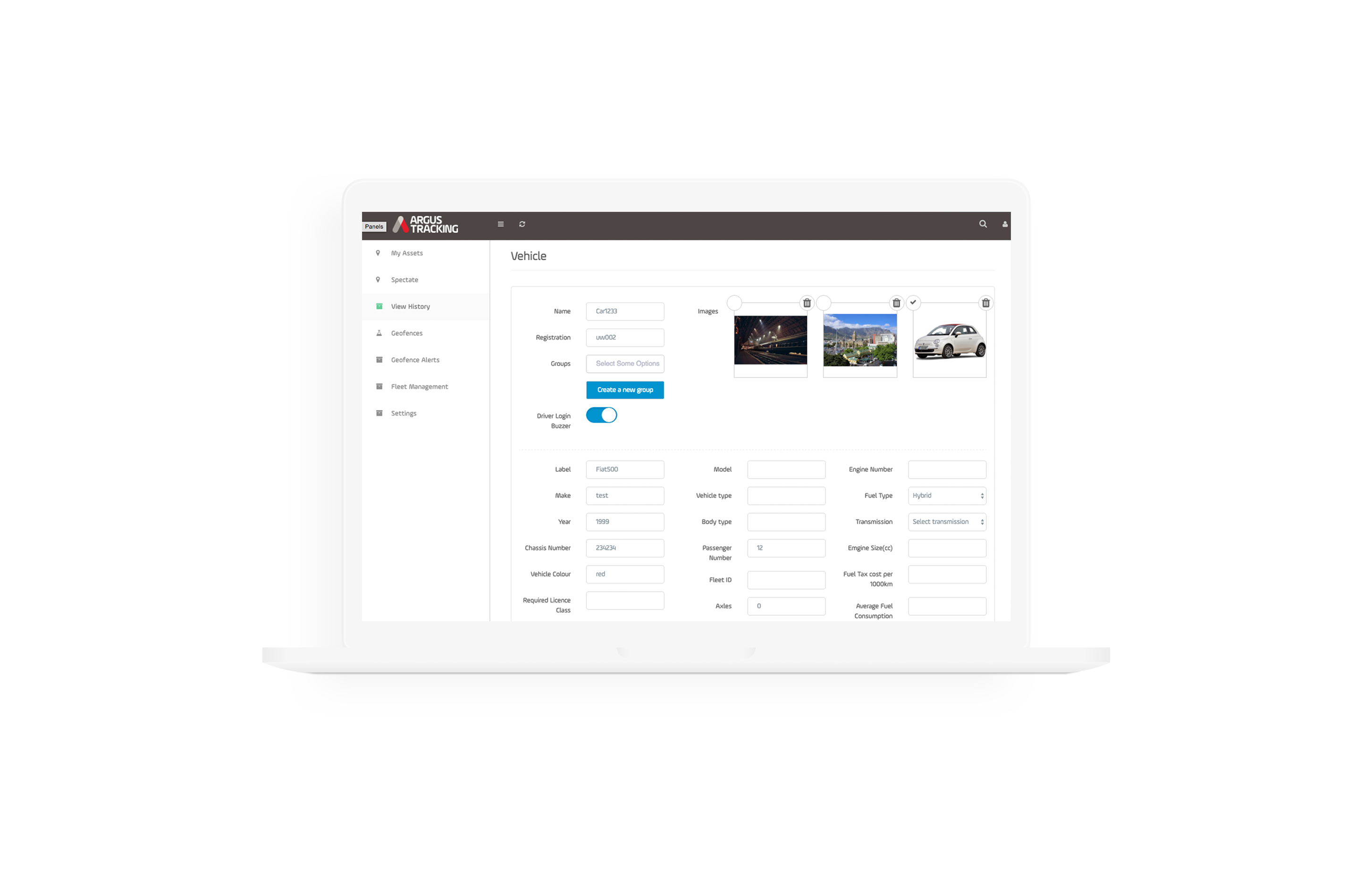
Real-time tracking and dashboard. The web-based back office provides an interactive dashboard with real-time vehicle locations, running cost meters, idle time tracking, and configurable alerts — speeding, geofence entry/exit, unauthorized use.
Historical reports support route replay, distance analysis, and utilization metrics per vehicle. To solve the coverage gap, Empeek implemented dual-connectivity tracking: cellular (4G/LTE) as primary and Iridium Short Burst Data as fallback.
The in-vehicle telematics unit buffers GPS positions locally during connectivity loss and transmits them with original timestamps once satellite connection resumes — enabling full path reconstruction with zero gaps.
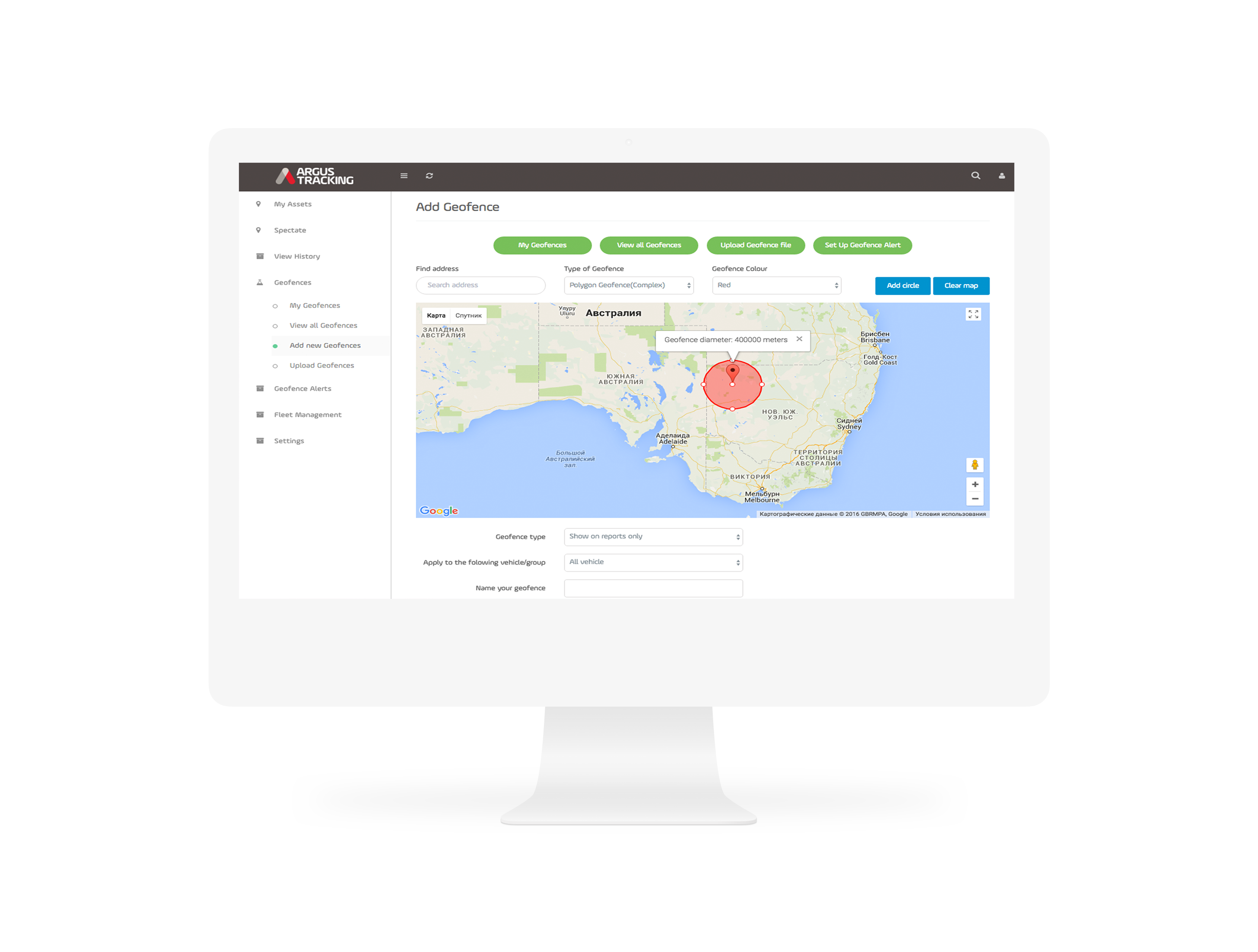
Geofencing engine. Empeek built a configurable geofencing system with dwell-time filtering to address urban GPS accuracy. A vehicle must remain within the geofence boundary for a minimum dwell time (default: 60 seconds) before the arrival event fires — filtering out GPS drift without missing genuine arrivals. Fleet managers define virtual boundaries around job sites, customer locations, and fuel stations. Drivers use geofence data in the mobile app to navigate to the nearest approved site, accelerating unloading and reducing detours.
Fuel supplier integration. Empeek built a normalized fuel data ingestion pipeline standardizing transaction data from all four suppliers — Mobil, BP, Caltex, and UBP — into a unified schema. Each fuel purchase is cross-referenced against the vehicle’s GPS position at the transaction timestamp, flagging transactions where the vehicle’s location doesn’t match the fuel station or where fuel volume exceeds the vehicle’s tank capacity.
Mobile apps. Two cross-platform apps serve distinct roles: a fleet manager app (live vehicle map, alerts, job assignment, cost overview) and a driver app (route guidance, job details, geofence-aware navigation, status reporting — replacing phone-based dispatch).
Technical stack. React.js web frontend with interactive mapping (Leaflet/Mapbox); cross-platform iOS + Android mobile apps; Node.js backend with REST API; PostgreSQL with PostGIS for geospatial queries; WebSocket infrastructure for live position updates; Redis for high-frequency location caching; Iridium SBD modules for satellite fallback.
Results
Empeek delivered the complete system as a production SaaS serving the NZ fleet management market. The platform is actively used by companies including Clarkson Electrical, Harrison Grierson, and Platform 4.

What the Client Got:
- Dual-connectivity tracking (cellular + Iridium satellite) with local position buffering for zero-gap coverage
- Geofencing engine with configurable boundaries and dwell-time filtering for urban GPS accuracy
- Normalized fuel data pipeline ingesting transactions from Mobil, BP, Caltex, and UBP with GPS cross-referencing
- Real-time web dashboard with interactive mapping, running cost meters, and historical reporting
- Mobile apps for fleet managers and drivers replacing phone-based dispatch
- SaaS multi-tenant architecture supporting per-customer configuration and onboarding within 2–3 weeks
Let’s Discuss Your Needs Today
Contact Us (No Ratings Yet)
 Loading...